
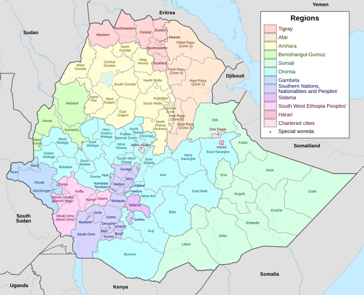
Image: Map of zones of Ethiopia

Size of this PNG preview of this SVG file: 740 × 600 pixels. Other resolution: 296 × 240 pixels.
Original image (SVG file, nominally 1,843 × 1,494 pixels, file size: 1.08 MB)
Description: Map of the regions and zones of Ethiopia. Previously based on boundaries used in UNOCHA 27 March 2013 map. Updated on 6 November 2017 to reflect Afar Zone 1 change in UNOCHA 5 January 2015 Map (border now diverts around Kurri woreda instead of cuts across).
Title: Map of zones of Ethiopia
Credit: Created from File:Ethiopia adm location map.svg by User:NordNordWest.
Author: File:Ethiopia adm location map.svg: User:NordNordWest Derivative work: User:SUM1
Usage Terms: Creative Commons Attribution-Share Alike 4.0
License: CC BY-SA 4.0
License Link: https://creativecommons.org/licenses/by-sa/4.0
Attribution Required?: Yes
Image usage
The following 2 pages link to this image:

All content from Kiddle encyclopedia articles (including the article images and facts) can be freely used under Attribution-ShareAlike license, unless stated otherwise.