
Image: Map png - crovan dynasty - isles
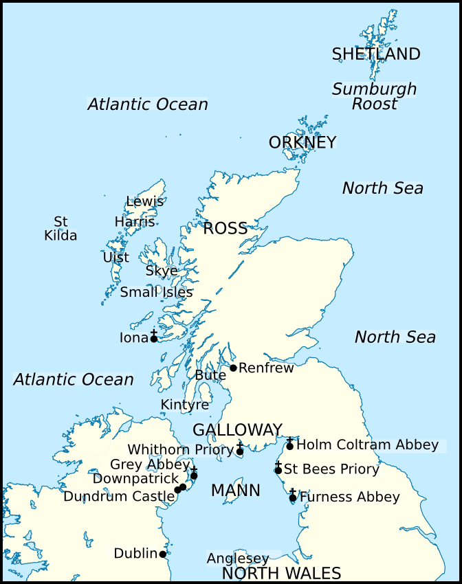
Description: Map of locations within and associated with the Kingdom of Mann and the Isles. Locations displayed in this map include: Anglesey, the Atlantic Ocean, Bute, Downpatrick, Dublin, Dundrum Castle, Furness Abbey, Galloway, Grey Abbey, Harris, Holm Cultram Abbey, Iona, Isle of Man (Mann), Kintyre, Lewis, the North Sea, North Wales, Orkney, Renfrew, Ross, Shetland, Skye, the Small Isles, St Bees Priory, St Kilda, Sumburgh Roost, Uist, and Whithorn Priory. I based this map off the maps published in the following book: McDonald, R.A. (2007). Manx Kingship in its Irish sea Setting, 1187–1229: King Rǫgnvaldr and the Crovan dynasty. Four Courts Press. 978-1-84682-047-2. pages 21–26.
Title: Map png - crovan dynasty - isles
Credit: I, Brianann MacAmhlaidh, created this work entirely by myself. I used the following file in creating this image: United Kingdom location map.svg, by NordNordWest.
Author: Brianann MacAmhlaidh (talk)
Usage Terms: Creative Commons Attribution-ShareAlike 3.0
License: CC-BY-SA-3.0
License Link: https://creativecommons.org/licenses/by-sa/3.0/
Attribution Required?: Yes
Image usage
The following page links to this image:
