
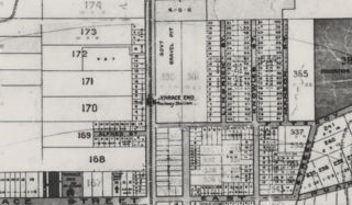
Image: Map section of North-east Palmerston North, 1906

Size of this preview: 800 × 468 pixels. Other resolutions: 320 × 187 pixels | 811 × 474 pixels.
Original image (811 × 474 pixels, file size: 485 KB, MIME type: image/png)
Description: Pictured is a section of a map of Palmerston North in 1906. Terrace end station is visible in the centre.
Title: Map section of North-east Palmerston North, 1906
Credit: Original publication: H J Wylde, H.J., (1906), Map of the Borough of Palmerston North, District of Wellington, New Zealand Immediate source: https://manawatuheritage.pncc.govt.nz/item/89e7a2ab-8606-4253-8d8a-dce50516d7a2
Author: H J Wylde (Life time: 1933)
Usage Terms: Public domain in the United States
License: PD-US-expired
License Link: //en.wikipedia.org/wiki/File:Map_section_of_North-east_Palmerston_North,_1906.png
Image usage
The following page links to this image:

All content from Kiddle encyclopedia articles (including the article images and facts) can be freely used under Attribution-ShareAlike license, unless stated otherwise.