
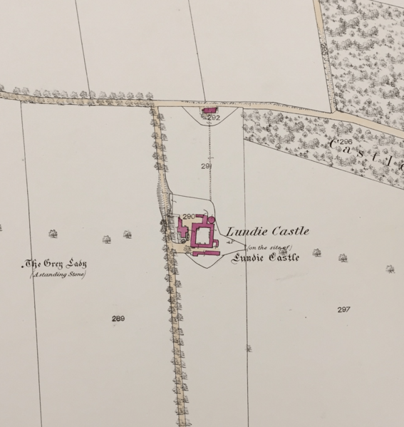
Image: Map showing the area of the former Lundie Castle

Size of this preview: 567 × 599 pixels. Other resolutions: 227 × 240 pixels | 909 × 961 pixels.
Original image (909 × 961 pixels, file size: 442 KB, MIME type: image/png)
Description: Lundie Castle was built a little before 1539 and had become ruins by 1823. It was a large square tower around 30 feet high (Carrie J (1881) Ancient Things in Angus: a series of articles on ancient things, manners and customs in Forfarshire. Arbroath:Thomas Buncle Publishers). NO33NW 13 30899 36122.(1863) scale: 25.344 inches to one mile.
Title: Map showing the area of the former Lundie Castle
Credit: Own work
Author: Craig Ward
Usage Terms: Creative Commons Attribution-Share Alike 4.0
License: CC BY-SA 4.0
License Link: https://creativecommons.org/licenses/by-sa/4.0
Attribution Required?: Yes
Image usage
The following page links to this image:

All content from Kiddle encyclopedia articles (including the article images and facts) can be freely used under Attribution-ShareAlike license, unless stated otherwise.