
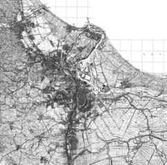
Image: Mapa miasta Danzig - lata 20. XX w

Size of this preview: 605 × 599 pixels. Other resolutions: 242 × 240 pixels | 861 × 853 pixels.
Original image (861 × 853 pixels, file size: 580 KB, MIME type: image/png)
Description: A 1920s map from a guide in the city of Danzig, officially Gdańsk since 1945. It was published in 1922-1928, the date is disputed. It has been archived on the metropolitan area's website, trojmiasto.pl. The link to the source is listed below.
Title: Mapa miasta Danzig - lata 20. XX w
Credit: https://mapa.trojmiasto.pl/#/map/-19.41,210.96,0,h,0;1;24;37
Author: Edward Carstenn
Usage Terms: Public domain
License: Public domain
Attribution Required?: No
Image usage
The following page links to this image:

All content from Kiddle encyclopedia articles (including the article images and facts) can be freely used under Attribution-ShareAlike license, unless stated otherwise.