
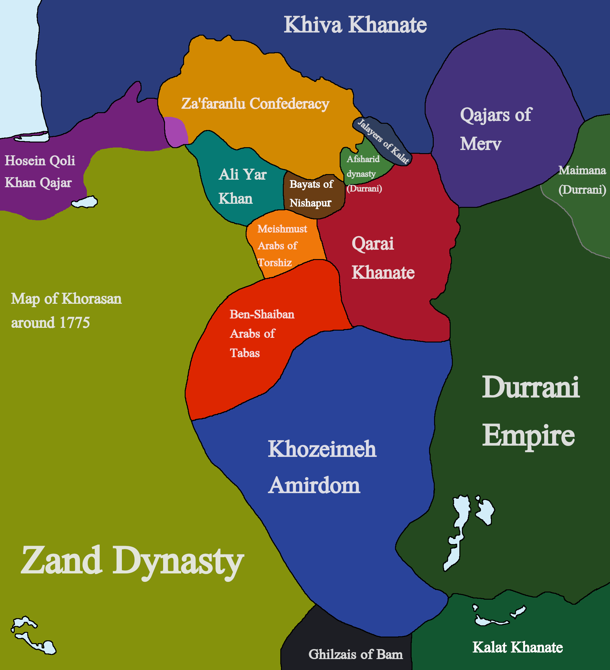
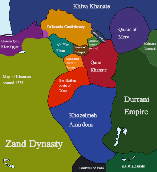
Image: Mapofkhorasan1775
Description: A map of Khorasan in 1775, showing the various factions that emerged in Khorasan after the death of Nader Shah and subsequent battles between Nader Mirza Afshar and Nasrullah Mirza Afshar. Sources used for the Creation of this map are as follows: The History of Persia, From the Most Early Period to the Present Time by Sir John Malcolm, various Encyclopedia Iranica articles, A Historical Atlas of Central Asia by Yuri Bregel, The gulf2000 project, THE REVOLT OF HOSEIN QOLI KHAN QAJAR, 1769-1777 by Shohei Komaki, Russian Wikipedia, and Evolution of Eastern Iranian Boundaries: Role of the Khozeimeh Amirdom of Qaenat and Sistan by Pirouz Mojtahed-Zadeh.
Title: Mapofkhorasan1775
Credit: Own work
Author: Kailanmapper
Usage Terms: Creative Commons Attribution-Share Alike 4.0
License: CC BY-SA 4.0
License Link: https://creativecommons.org/licenses/by-sa/4.0
Attribution Required?: Yes
Image usage
The following page links to this image:
