
Image: Mara and Mondrem

Size of this preview: 597 × 600 pixels. Other resolutions: 239 × 240 pixels | 800 × 804 pixels.
Original image (800 × 804 pixels, file size: 100 KB, MIME type: image/png)
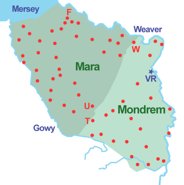
Description: Sketch map of the forests of Mara and Mondrem (at a date between 1277 & 1536). Red dot: township within the forest; F: Frodsham; T: Tarporley; U: Utkinton; VR: Vale Royal Abbey; W: Weaverham.
Title: Mara and Mondrem
Credit: Own work
Author: Espresso Addict
Usage Terms: Creative Commons Attribution-Share Alike 3.0
License: CC BY-SA 3.0
License Link: https://creativecommons.org/licenses/by-sa/3.0
Attribution Required?: Yes
Image usage
The following 2 pages link to this image:

All content from Kiddle encyclopedia articles (including the article images and facts) can be freely used under Attribution-ShareAlike license, unless stated otherwise.