
Image: Marathas India (1758)
Size of this preview: 500 × 600 pixels. Other resolutions: 200 × 240 pixels | 722 × 866 pixels.
Original image (722 × 866 pixels, file size: 64 KB, MIME type: image/jpeg)
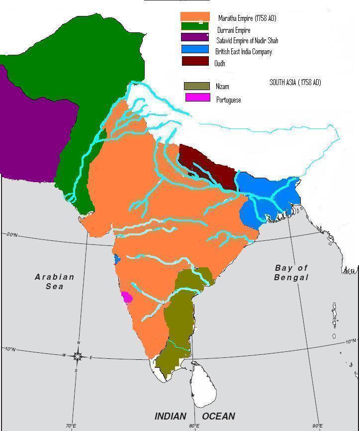
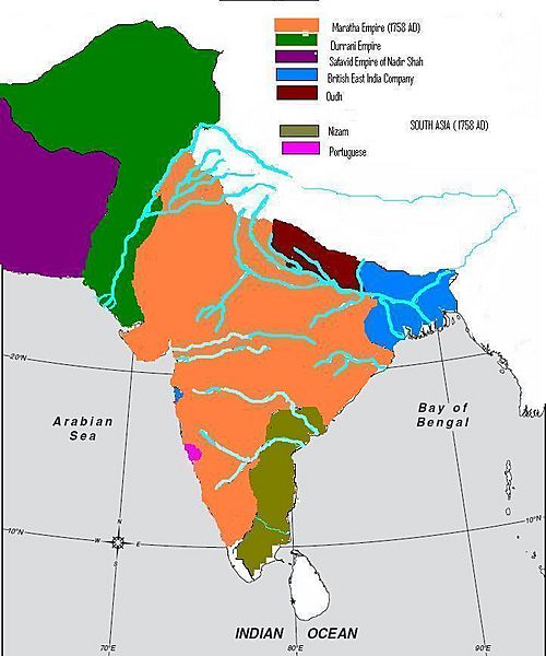
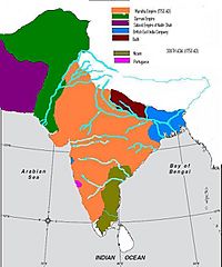
Description: Political map of Indian subcontinent, 1758. Shown here in orange is the Maratha Empire and the green one is Durrani Empire.
Title: Marathas India (1758)
Credit: Historical Atlas by Raman, Ranjoy ; L.K. Publications Delhi, 1951.
Author: Raman, Ranjoy
Usage Terms: Public domain
License: Public domain
Attribution Required?: No
Image usage
There are no pages that link to this image.

All content from Kiddle encyclopedia articles (including the article images and facts) can be freely used under Attribution-ShareAlike license, unless stated otherwise.
.jpg)