
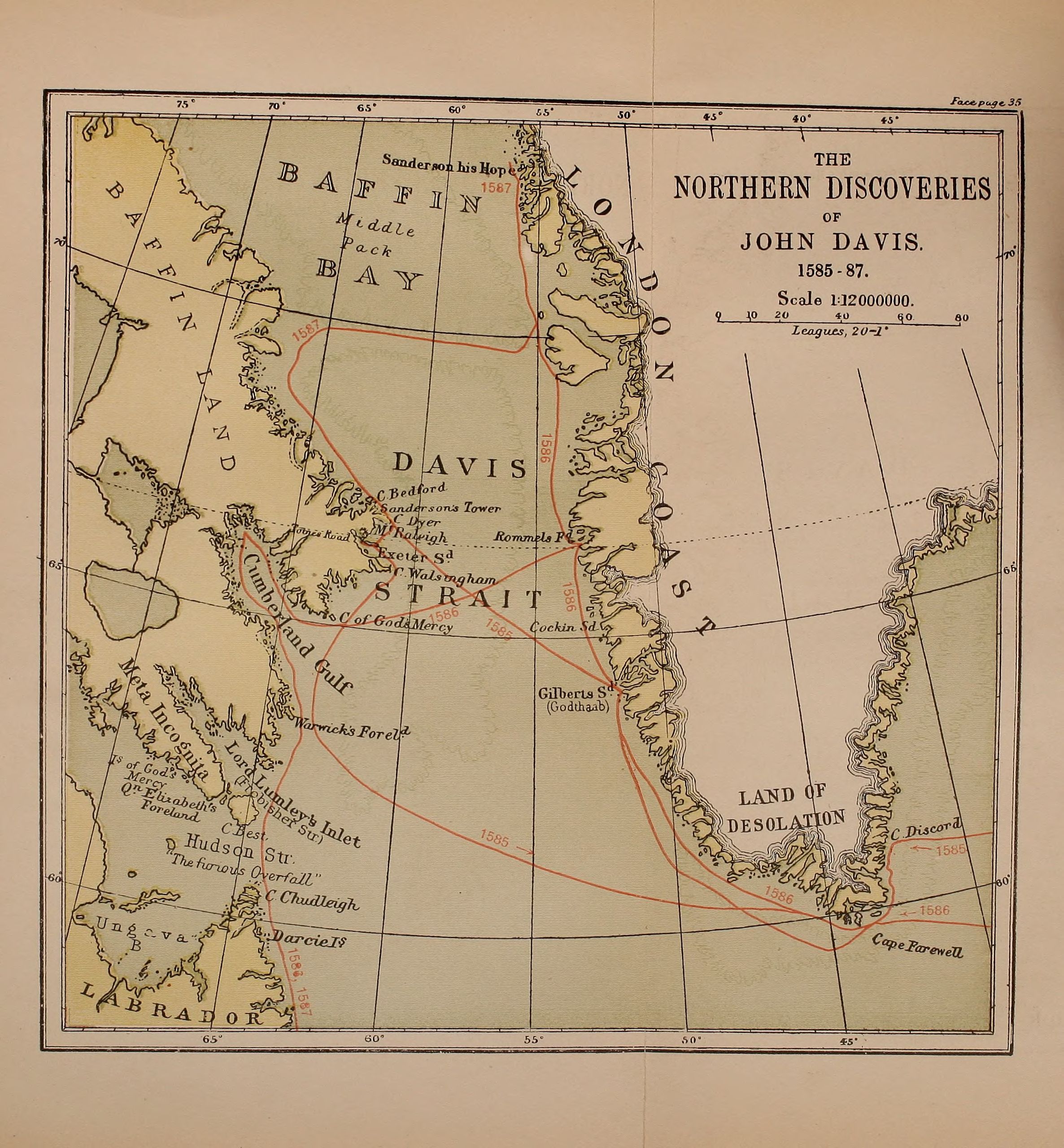
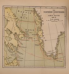
Image: Markham Davis Strait map
Size of this preview: 556 × 600 pixels. Other resolutions: 222 × 240 pixels | 2,372 × 2,559 pixels.
Original image (2,372 × 2,559 pixels, file size: 916 KB, MIME type: image/jpeg)
Description: Map of the Northern Discoveries of John Davis 1585-87. From Clements Markham A life of John Davis, the navigator, 1550-1605, discoverer of Davis straits.
Title: Markham Davis Strait map
Credit: https://archive.org/details/lifeofjohndavisn01mark/page/n53
Author: Clements Markham
Usage Terms: Public domain
License: Public domain
Attribution Required?: No
Image usage
The following page links to this image:

All content from Kiddle encyclopedia articles (including the article images and facts) can be freely used under Attribution-ShareAlike license, unless stated otherwise.