
Image: Marreman comparison
Size of this preview: 700 × 600 pixels. Other resolutions: 280 × 240 pixels | 2,308 × 1,977 pixels.
Original image (2,308 × 1,977 pixels, file size: 704 KB, MIME type: image/jpeg)
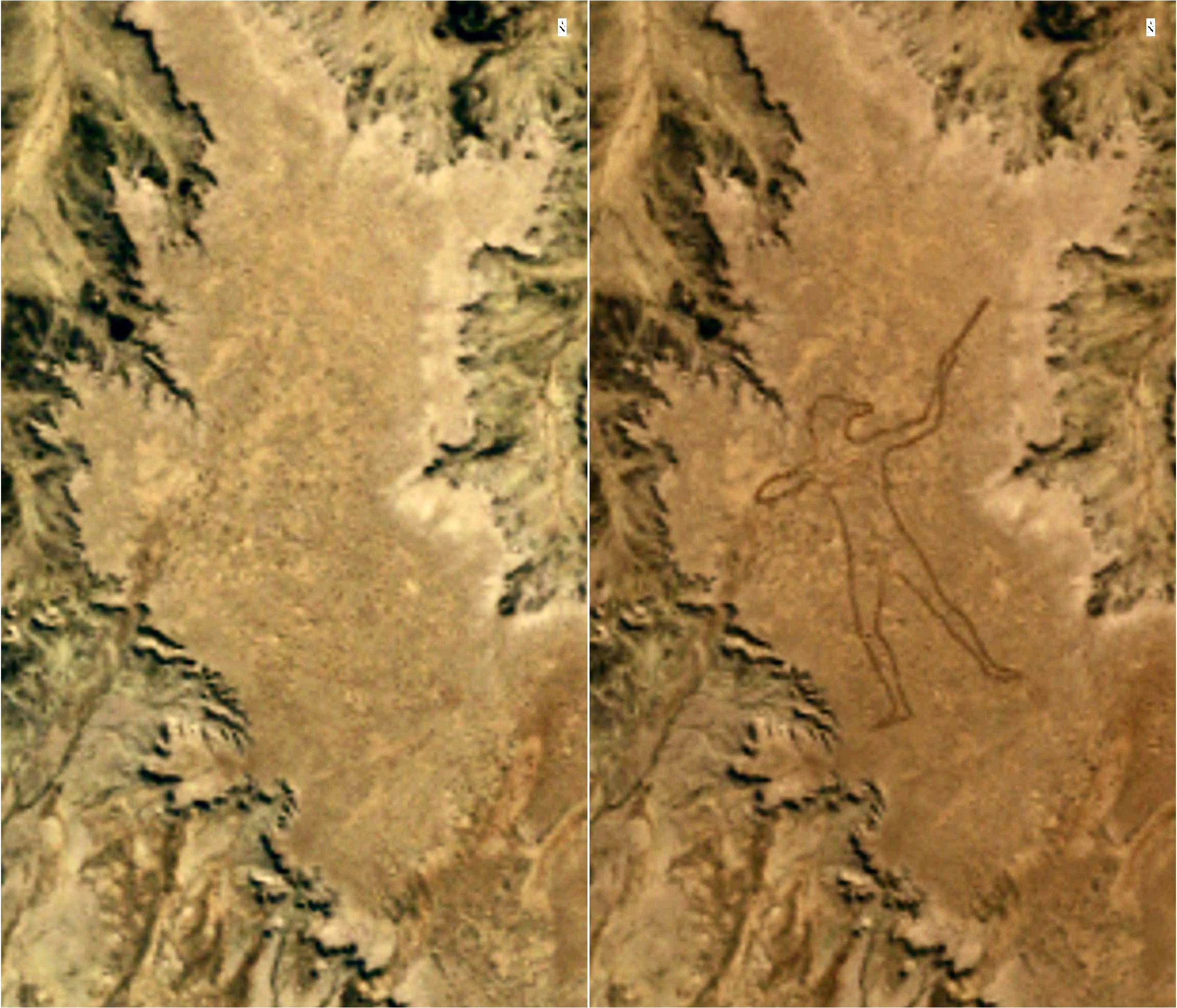
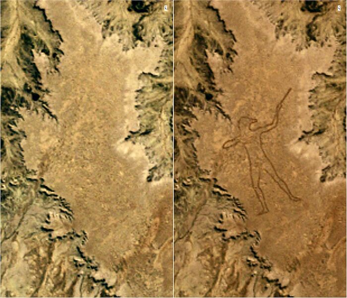
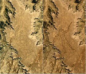
Description: Comparison of two satellite images from USGS/NASA's Landsat-5 satellite over the site of the Marree Man geoglyph in outback South Australia. The image on the left, taken on 27 May 1998, shows the desert area untouched. The image on the right, taken on 12 June 1998 over the same area, shows the completed 3.5-kilometre (2.2-mile) long Marree Man.
Title: Marree Man comparison
Credit: Landsat image Gallery (search 27 May 1998 and 12 June 1998)
Author: USGS/NASA Landsat project (images combined by Pmallas)
Usage Terms: Public domain
License: Public domain
Attribution Required?: No
Image usage
The following page links to this image:

All content from Kiddle encyclopedia articles (including the article images and facts) can be freely used under Attribution-ShareAlike license, unless stated otherwise.