
Image: Maryland Indigenous Tribes
Size of this PNG preview of this SVG file: 800 × 509 pixels. Other resolution: 320 × 204 pixels.
Original image (SVG file, nominally 1,200 × 764 pixels, file size: 461 KB)
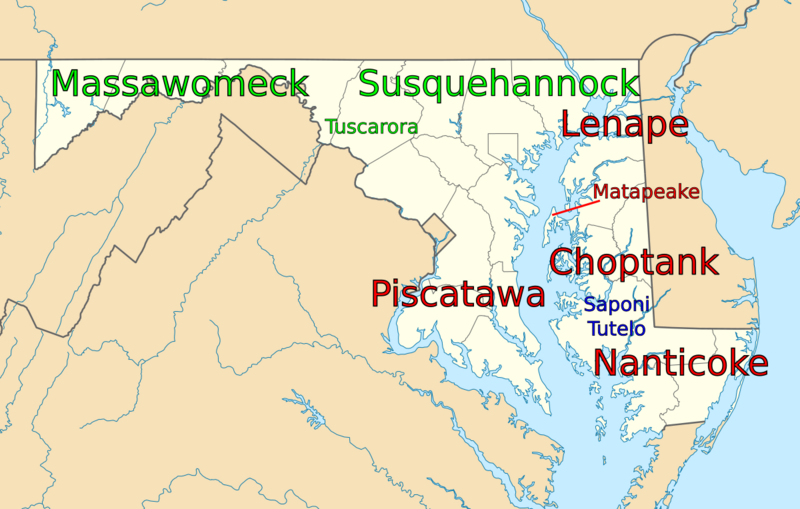
Description: Map of Native American tribal areas within the U.S. state of Maryland, generally prior to European arrival. Names are tribe names, and colors represent nations/peoples. Red is Algonquin, Green is Iroquois, and Blue is Siouan. Note that the Tuscarora tribe was in the area only from 1719-1721, and the Siouan tribes arrived in the mid-1700s.
Title: Maryland Indigenous Tribes
Credit: File:USA_Maryland_location_map.svg
Author: Original map by User:Alexrk2
Usage Terms: Creative Commons Attribution-Share Alike 3.0
License: CC BY-SA 3.0
License Link: https://creativecommons.org/licenses/by-sa/3.0
Attribution Required?: Yes
Image usage
The following page links to this image:

All content from Kiddle encyclopedia articles (including the article images and facts) can be freely used under Attribution-ShareAlike license, unless stated otherwise.