
Image: Massachusetts Central Railroad 1871 Map

Size of this preview: 800 × 540 pixels. Other resolutions: 320 × 216 pixels | 5,967 × 4,028 pixels.
Original image (5,967 × 4,028 pixels, file size: 3.96 MB, MIME type: image/jpeg)
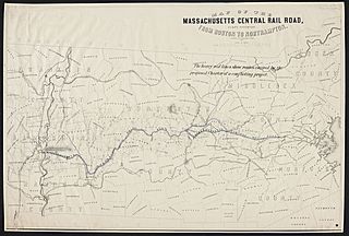
Description: A map of the Massachusetts Central Railroad's proposed route from 1871
Title: Massachusetts Central Railroad 1871 Map
Credit: Massachusetts State Library Archives
Author: J. H. Bufford's Lithography
Usage Terms: Public domain
License: Public domain
Attribution Required?: No
Image usage
The following page links to this image:

All content from Kiddle encyclopedia articles (including the article images and facts) can be freely used under Attribution-ShareAlike license, unless stated otherwise.