
Image: Mauritius Island topographic map-de

Size of this PNG preview of this SVG file: 502 × 599 pixels. Other resolution: 201 × 240 pixels.
Original image (SVG file, nominally 1,810 × 2,160 pixels, file size: 1.93 MB)
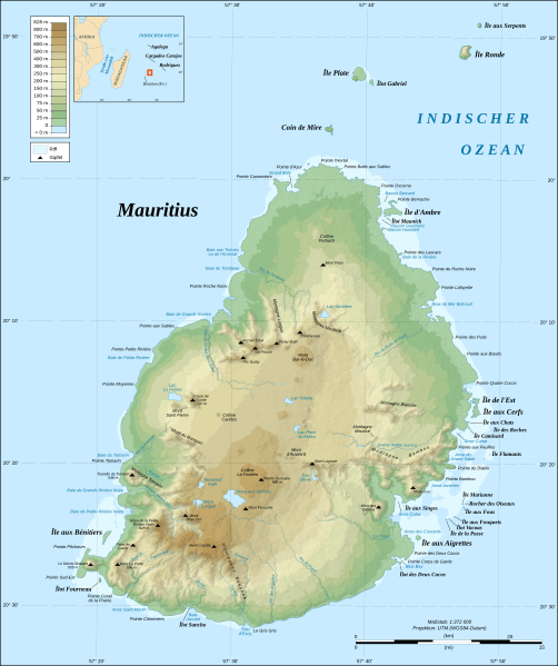
Description: Topographic map in German of Mauritius Island.
Title: Mauritius Island topographic map-de
Credit: Own work; Topographic data: NASA Shuttle Radar Topography Mission (SRTM3 v.2) (public domain); Reef limits: created from Landsat ETM+ imagery (14.25 m resolution – public domain); Additional reference: Map of Mauritius' government.
Author: Eric Gaba (Sting - fr:Sting); translated by NordNordWest
Permission: GFDL / Creative Commons Attribution and Share-Alike required
Usage Terms: Creative Commons Attribution-Share Alike 4.0
License: CC BY-SA 4.0
License Link: https://creativecommons.org/licenses/by-sa/4.0
Attribution Required?: Yes
Image usage
There are no pages that link to this image.

All content from Kiddle encyclopedia articles (including the article images and facts) can be freely used under Attribution-ShareAlike license, unless stated otherwise.