
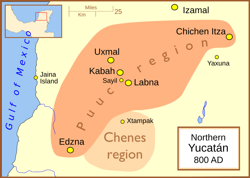
Image: Maya site northern Yucatan 800 AD

Size of this PNG preview of this SVG file: 800 × 570 pixels. Other resolution: 320 × 228 pixels.
Original image (SVG file, nominally 1,788 × 1,273 pixels, file size: 88 KB)
Description: A map showing the major Maya sites and regions of the northern Yucatán peninsula, with a general date of AD 800 (CE). The regional boundaries are based on: Coe, Michael; Snow, Dean; Benson, Elizabeth; (1986) Atlas of Ancient America; Facts on File, New York.
Title: Maya site northern Yucatan 800 AD
Credit: No machine-readable source provided. Own work assumed (based on copyright claims).
Author: No machine-readable author provided. Madman2001 assumed (based on copyright claims).
Usage Terms: Creative Commons Attribution 2.5
License: CC BY 2.5
License Link: https://creativecommons.org/licenses/by/2.5
Attribution Required?: Yes
Image usage
The following 2 pages link to this image:

All content from Kiddle encyclopedia articles (including the article images and facts) can be freely used under Attribution-ShareAlike license, unless stated otherwise.