
Image: Melbourne Airport Rail link map
Size of this preview: 488 × 600 pixels. Other resolutions: 195 × 240 pixels | 2,000 × 2,457 pixels.
Original image (2,000 × 2,457 pixels, file size: 160 KB, MIME type: image/png)
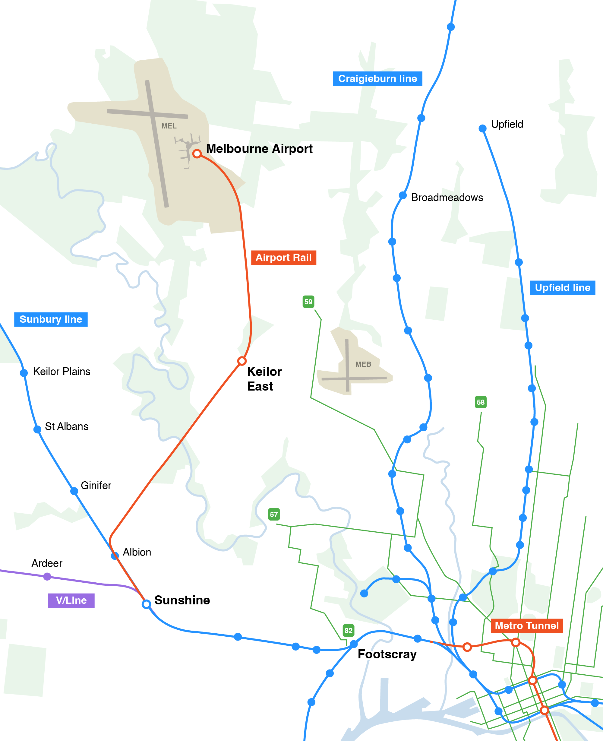
Description: Map of the Melbourne Airport Rail link, an under construction metro line in Melbourne, Australia, showing nearby public transport in the north-west of Melbourne. The under construction Metro Tunnel is also shown, Airport trains will run through the Melbourne CBD via the tunnel. Not all station names are shown, the route is approximate and based on government-supplied maps.
Title: Melbourne Airport Rail link map
Credit: Own work
Author: Gracchus250
Usage Terms: Creative Commons Attribution-Share Alike 4.0
License: CC BY-SA 4.0
License Link: https://creativecommons.org/licenses/by-sa/4.0
Attribution Required?: Yes
Image usage
The following page links to this image:

All content from Kiddle encyclopedia articles (including the article images and facts) can be freely used under Attribution-ShareAlike license, unless stated otherwise.