
Image: Mercia map

Size of this PNG preview of this SVG file: 551 × 599 pixels. Other resolution: 221 × 240 pixels.
Original image (SVG file, nominally 1,945 × 2,115 pixels, file size: 1.87 MB)
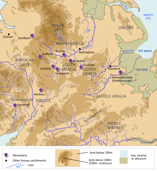
Description: A map of Mercia, made using information from OpenStreetMap, Hill 'An Atlas of Anglo-Saxon England' and Stenton, 'Anglo-Saxon England'
Author: Hel-hama
Usage Terms: Creative Commons Attribution-Share Alike 3.0
License: CC-BY-SA-3.0
License Link: http://creativecommons.org/licenses/by-sa/3.0/
Attribution Required?: Yes
Image usage
There are no pages that link to this image.

All content from Kiddle encyclopedia articles (including the article images and facts) can be freely used under Attribution-ShareAlike license, unless stated otherwise.