
Image: MiG Alley Map (en)

Size of this PNG preview of this SVG file: 557 × 599 pixels. Other resolution: 223 × 240 pixels.
Original image (SVG file, nominally 696 × 749 pixels, file size: 135 KB)
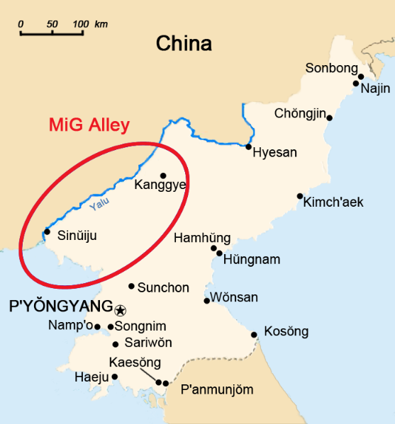
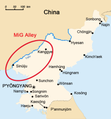
Description: The area called "MiG Alley" during the Korean War (1950-53) on the Chinese-North Korean border. See also: File:Usaf-korea-map.jpg (US Army)
Title: MiG Alley Map (en)
Credit: This file was derived from: MiG Alley Map.JPG
Author: Triggerhappy (original) / Howard61313 (derivative work)
Usage Terms: Public domain
License: Public domain
Attribution Required?: No
Image usage
The following page links to this image:

All content from Kiddle encyclopedia articles (including the article images and facts) can be freely used under Attribution-ShareAlike license, unless stated otherwise.
.svg)