
Image: MiamiRegion8x11

Size of this preview: 776 × 600 pixels. Other resolutions: 311 × 240 pixels | 1,056 × 816 pixels.
Original image (1,056 × 816 pixels, file size: 123 KB, MIME type: image/jpeg)
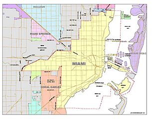
Description: City of Miami General Boundary Map
Title: MiamiRegion8x11
Credit: http://www.ci.miami.fl.us/Planning/pages/services/Maps.asp
Author: City of Miami
Usage Terms: Public domain
License: Public domain
Attribution Required?: No
Image usage
There are no pages that link to this image.

All content from Kiddle encyclopedia articles (including the article images and facts) can be freely used under Attribution-ShareAlike license, unless stated otherwise.