
Image: Michigan map 1839

Size of this preview: 502 × 600 pixels. Other resolutions: 201 × 240 pixels | 544 × 650 pixels.
Original image (544 × 650 pixels, file size: 130 KB, MIME type: image/jpeg)
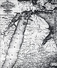
Description: 1839 Michigan map.
Title: Michigan map 1839
Credit: S. Augustus Mitchell map publishers of Philadelphia
Author: S. Augustus Mitchell
Permission: public domain (age)
Usage Terms: Public domain
License: Public domain
Attribution Required?: No
Image usage
The following page links to this image:

All content from Kiddle encyclopedia articles (including the article images and facts) can be freely used under Attribution-ShareAlike license, unless stated otherwise.