
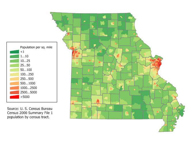
Image: Missouri population map (2000)
No higher resolution available.
Missouri_population_map_(2000).png (660 × 490 pixels, file size: 33 KB, MIME type: image/png)
Description: Missouri state population density map based on Census 2000 data. See the data lineage for a process description.
Title: Missouri population map (2000)
Author: User:JimIrwin
Usage Terms: Creative Commons Attribution-Share Alike 3.0
License: CC-BY-SA-3.0
License Link: http://creativecommons.org/licenses/by-sa/3.0/
Attribution Required?: Yes
Image usage
The following page links to this image:

All content from Kiddle encyclopedia articles (including the article images and facts) can be freely used under Attribution-ShareAlike license, unless stated otherwise.
.png)