
Image: MitchellMap-SouthernNovaScotia
Size of this preview: 745 × 599 pixels. Other resolutions: 298 × 240 pixels | 2,904 × 2,336 pixels.
Original image (2,904 × 2,336 pixels, file size: 2.6 MB, MIME type: image/jpeg)
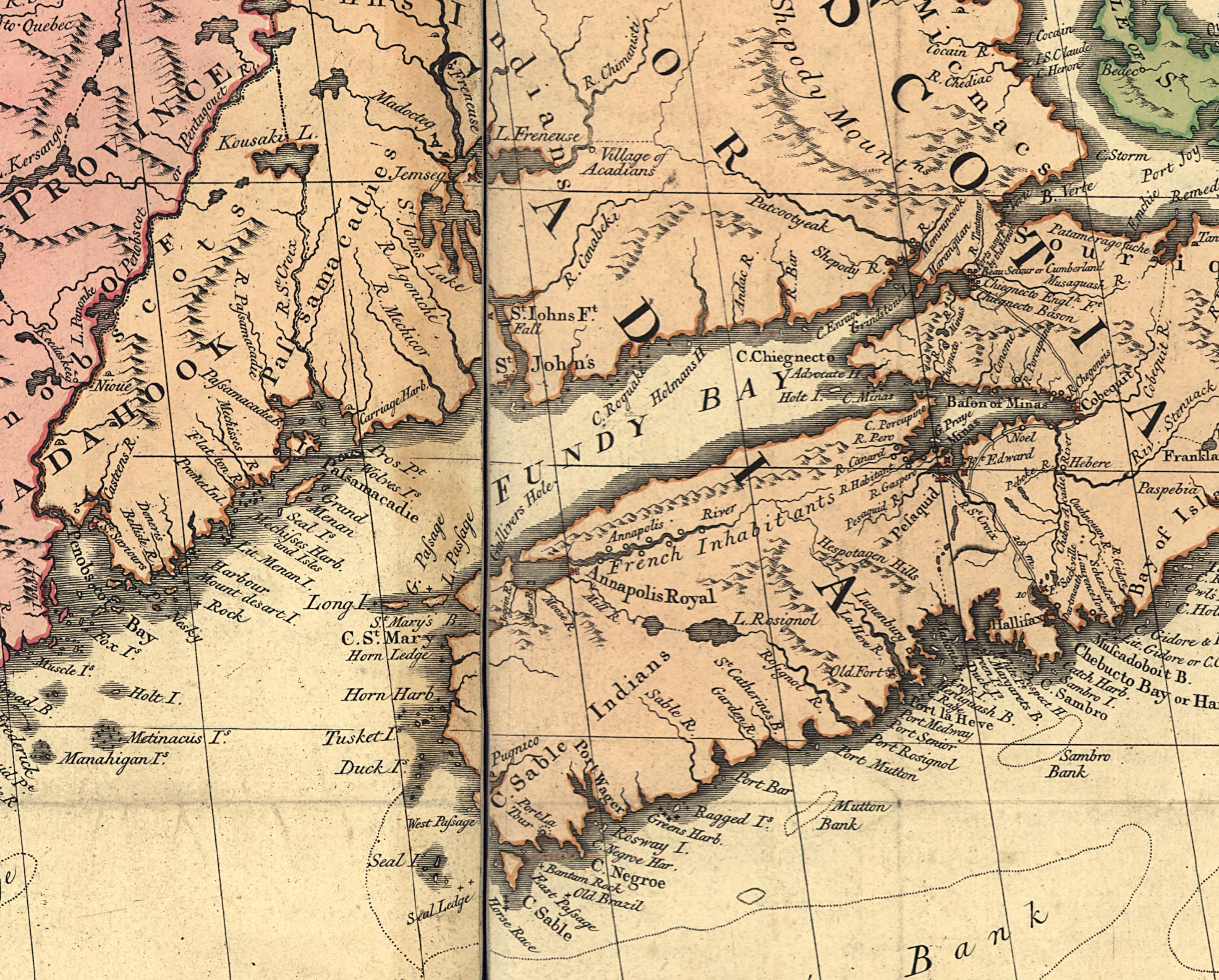
Description: This is a section of the Mitchell Map depicting southern Nova Scotia, the Bay of Fundy and coastal Maine as far west as Penobscot Bay.
Title: MitchellMap-SouthernNovaScotia
Credit: This map is available from the United States Library of Congress's Geography & Map Division under the digital ID g3300.ar004200. This tag does not indicate the copyright status of the attached work. A normal copyright tag is still required. See Commons:Licensing.
Author: John Mitchell
Usage Terms: Public domain
License: Public domain
Attribution Required?: No
Image usage
The following page links to this image:

All content from Kiddle encyclopedia articles (including the article images and facts) can be freely used under Attribution-ShareAlike license, unless stated otherwise.