
Image: Mokelumnemap
Size of this preview: 800 × 423 pixels. Other resolutions: 320 × 169 pixels | 1,005 × 532 pixels.
Original image (1,005 × 532 pixels, file size: 257 KB, MIME type: image/jpeg)
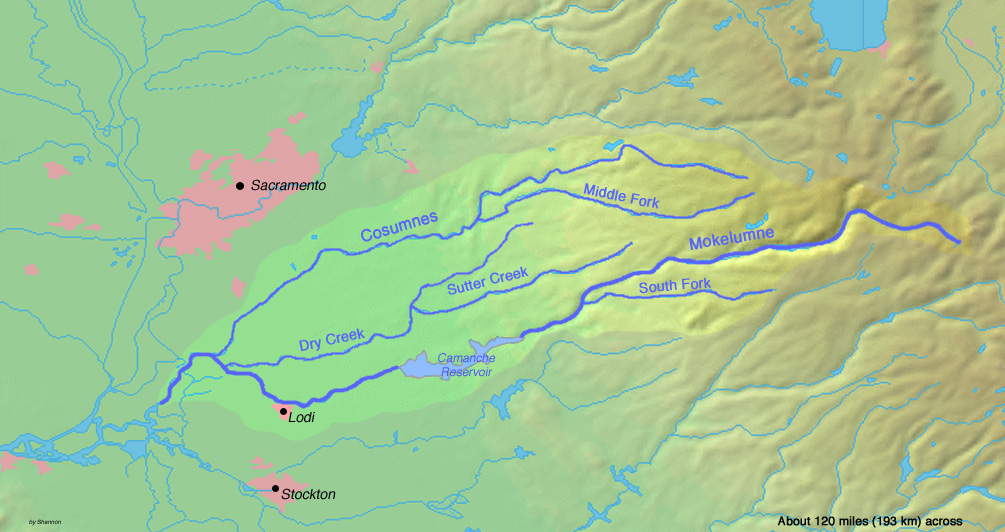
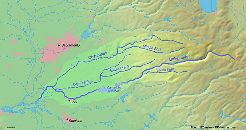
Description: Map of the [[:|Mokelumne River]] watershed in north-central California. The Mokelumne watershed's headwaters are in the Sierra Nevada, which then drains through the San Joaquin Valley —to the Sacramento-San Joaquin River Delta in the Central Valley of California.
Title: Mokelumnemap
Credit: Background and river courses from http://www2.demis.nl/mapserver/mapper.asp
Author: Background layer attributed to DEMIS Mapserver, map created by Shannon1
Permission: Map created from DEMIS Mapserver, which are public domain.
Usage Terms: Creative Commons Attribution-Share Alike 4.0
License: CC BY-SA 4.0
License Link: https://creativecommons.org/licenses/by-sa/4.0
Attribution Required?: Yes
Image usage
The following page links to this image:

All content from Kiddle encyclopedia articles (including the article images and facts) can be freely used under Attribution-ShareAlike license, unless stated otherwise.