
Image: NATO AB in France map-en

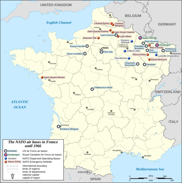
Description: Map of the United States Air Force bases, Royal Canadian Air Force bases and NATO Dispersed Operating Bases in France from 1951 to 1966.
Title: NATO AB in France map-en
Credit: Own work Source of data for the background map: NGDC World Data Bank II (public domain); Icon for the USAF AB: USAAC roundel 1942-1943.svg (color modified) (public domain); Icon for the RCAF: Roundel of the Royal Canadian Air Force (1946-1965).svg (public domain).
Author: Eric Gaba (Sting
Permission: Attribution and Share-Alike required Any use of this map can be made as long as you credit me (Eric Gaba – Wikimedia Commons user: Sting) as the author and distribute the copies and derivative works under the same license(s) that the one(s) stated below. A message with a reply address would also be greatly appreciated.
Usage Terms: Creative Commons Attribution-Share Alike 4.0
License: CC BY-SA 4.0
License Link: https://creativecommons.org/licenses/by-sa/4.0
Attribution Required?: Yes
Image usage
The following page links to this image:
