
Image: NPS isle-royale-rock-harbor-map
Size of this preview: 521 × 600 pixels. Other resolutions: 208 × 240 pixels | 1,100 × 1,266 pixels.
Original image (1,100 × 1,266 pixels, file size: 213 KB, MIME type: image/jpeg)
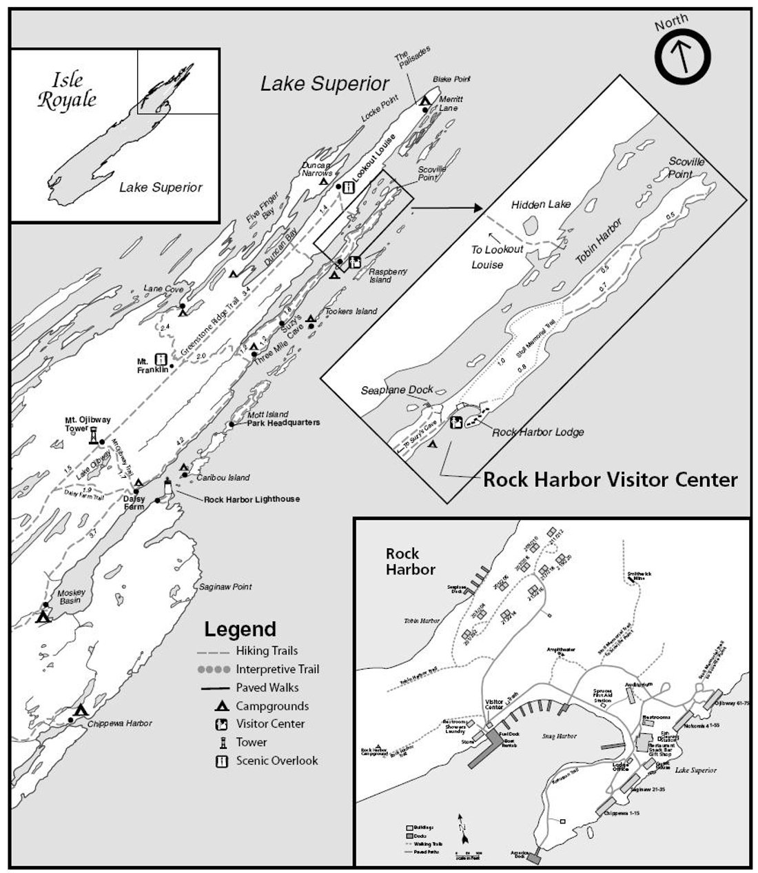
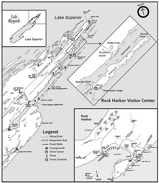
Description: Detail map of the Rock Harbor area, showing trails,locations of campsites, scenic overlooks, and points of interest near Rock Harbor in the northeastearn portion of Isle Royale.
Title: NPS isle-royale-rock-harbor-map
Credit: Isle Royale National Park Maps (https://npmaps.com/isle-royale)
Author: U.S. National Park Service, restoration/cleanup by National Park Maps (https://npmaps.com)
Usage Terms: Public domain
License: Public domain
Attribution Required?: No
Image usage
The following page links to this image:

All content from Kiddle encyclopedia articles (including the article images and facts) can be freely used under Attribution-ShareAlike license, unless stated otherwise.