
Image: NYTMap2ndBattleOfYpres1915
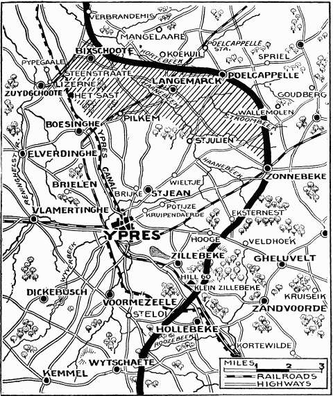
Description: "Current History" (New York Times) map showing reported positions during the Second Battle of Ypres, as at about 30 April 1915. On 1 May the British withdrew to shorten their lines, with the final front line running through Hooge, Frenzenberg (not shown, but 1 3/4 mile sw of Zonnebeke) and west to Mouse Trap farm and Turco farms (not shown, but 1 mile sw of St Julien). The map is largely correct. By the end of the battle German forces had in fact captured St Julien and Zonnebeke. NYT caption : "The German rush across the Yser-Ypres Canal was checked at Lizerne and opposite Boesinghe. The shaded area on the map marks the scene of the battle. Within this area are Steenstraate, Het Sast, Pilkem, St. Julien, and Langemarck, all of which the Germans claimed to have captured."
Title: NYTMap2ndBattleOfYpres1915
Credit: New York Times Current History. The European War, Vol. 2 No. 3, June 1915. Downloaded from http://www.gutenberg.org/ebooks/15480
Author: "Current History" (New York Times)
Usage Terms: Public domain
License: Public domain
Attribution Required?: No
Image usage
There are no pages that link to this image.
