
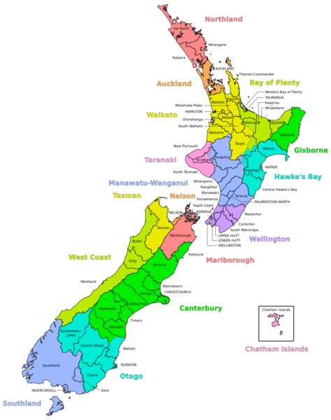
Image: NZ Regional Councils and Territorial Authorities 2017

Size of this PNG preview of this SVG file: 474 × 600 pixels. Other resolution: 190 × 240 pixels.
Original image (SVG file, nominally 1,380 × 1,746 pixels, file size: 1.82 MB)
Description: Map of the Territorial Authorities of New Zealand overlayed with Regional Council areas, including the Chatham Islands in an inset. Territorial Authorities, Regional Councils and text labels are in three separate layers. Map created with GIS data from StatsNZ [1] (Retrieved March 2017).
Title: NZ Regional Councils and Territorial Authorities 2017
Credit: Own work
Author: Korakys
Usage Terms: Creative Commons Attribution-Share Alike 4.0
License: CC BY-SA 4.0
License Link: https://creativecommons.org/licenses/by-sa/4.0
Attribution Required?: Yes
Image usage
The following page links to this image:

All content from Kiddle encyclopedia articles (including the article images and facts) can be freely used under Attribution-ShareAlike license, unless stated otherwise.