
Image: Nantes comblements

Size of this preview: 645 × 599 pixels. Other resolutions: 258 × 240 pixels | 1,586 × 1,474 pixels.
Original image (1,586 × 1,474 pixels, file size: 851 KB, MIME type: image/png)
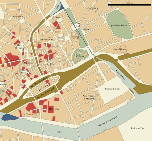
Description: Map of Central Nantes in the first half of the 20th century (made after Plan de Nantes by Jouanne and Veloppé, 1916-1917 and Stadtplan von Nantes, 1941) showing in brown the waterways filled in 1926-1946. In red are showned buildings that were destroyed or severely damaged during the American raids in 1943 (according to Nantes bombardements 1939-1945, partially available here).
Title: Nantes comblements
Credit: Own work
Author: Oie blanche
Usage Terms: Creative Commons Attribution-Share Alike 4.0
License: CC BY-SA 4.0
License Link: http://creativecommons.org/licenses/by-sa/4.0
Attribution Required?: Yes
Image usage
The following page links to this image:

All content from Kiddle encyclopedia articles (including the article images and facts) can be freely used under Attribution-ShareAlike license, unless stated otherwise.