
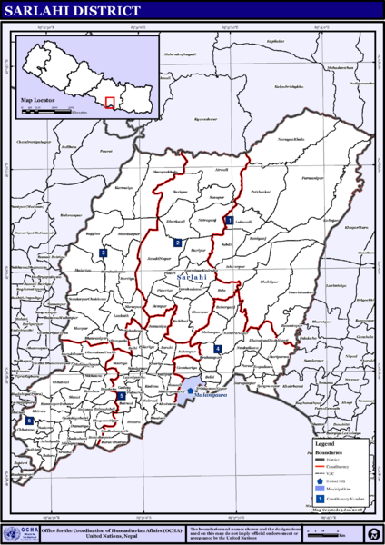
Image: NepalSarlahiDistrictmap

Size of this preview: 424 × 600 pixels. Other resolutions: 169 × 240 pixels | 2,479 × 3,508 pixels.
Original image (2,479 × 3,508 pixels, file size: 327 KB, MIME type: image/png)
Description: Map displaying Village Development Committees in Sarlahi District, Janakpur Zone, Nepal
Title: NepalSarlahiDistrictmap
Credit: http://www.un.org.np/maps/district-constituency-maps/central/Sarlahi.pdf
Author: United Nations
Usage Terms: Public domain
License: Public domain
Attribution Required?: No
Image usage
The following page links to this image:

All content from Kiddle encyclopedia articles (including the article images and facts) can be freely used under Attribution-ShareAlike license, unless stated otherwise.