
Image: Nevada State Prison USGS

Size of this preview: 750 × 600 pixels. Other resolutions: 300 × 240 pixels | 1,000 × 800 pixels.
Original image (1,000 × 800 pixels, file size: 142 KB, MIME type: image/jpeg)
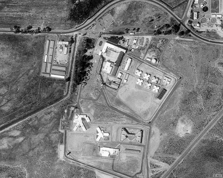
Description: Aerial photo of Nevada State Prison at Carson City in 1999, before U.S. Route 395 was constructed at the west side of the prison.
Title: Nevada State Prison USGS
Credit: Microsoft Research Maps
Author: The National Map, United States Geological Survey
Usage Terms: Public domain
License: Public domain
Attribution Required?: No
Image usage
The following page links to this image:

All content from Kiddle encyclopedia articles (including the article images and facts) can be freely used under Attribution-ShareAlike license, unless stated otherwise.