
Image: New Jersey Legislative Districts Map (2011)

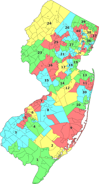
Description: A map of the 40 legislative districts in New Jersey following the reapportionment by the New Jersey Apportionment Commission due to the 2010 United States Census. Districts are grouped by municipalities contained by each of the districts.
Title: New Jersey Legislative Districts Map (2011)
Credit: Municipalities from File:Map of New Jersey municipalities.svg (created by me) and data from http://online.wsj.com/public/resources/documents/njdemmap0402.pdf or http://njtoday.net/wp-content/uploads/2011/04/NJ-State-Legislative-Districts.pdf .
Author: Mr. Matté (if there is an issue with this image, contact me using this image's Commons talk page or my English Wikipedia talk page; I'll know about it a lot faster)
Usage Terms: Creative Commons Zero, Public Domain Dedication
License: CC0
License Link: http://creativecommons.org/publicdomain/zero/1.0/deed.en
Attribution Required?: No
Image usage
The following page links to this image:

.svg)