
Image: New Passage Map

Size of this preview: 800 × 593 pixels. Other resolutions: 320 × 237 pixels | 1,600 × 1,186 pixels.
Original image (1,600 × 1,186 pixels, file size: 337 KB, MIME type: image/jpeg)
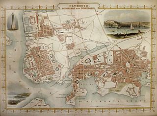
Description: Map of Plymouth and Devonport about 1851
Title: New Passage Map
Credit: old map
Author: The map was drawn and engraved by John Rapkin (1815-1876) while the illustrations are drawn and engraved by H. Bibby. Publisher: John Tallis (1817-1876) - London Printing & Publishing Company
Usage Terms: Public domain
License: Public domain
Attribution Required?: No
Image usage
The following 3 pages link to this image:

All content from Kiddle encyclopedia articles (including the article images and facts) can be freely used under Attribution-ShareAlike license, unless stated otherwise.