
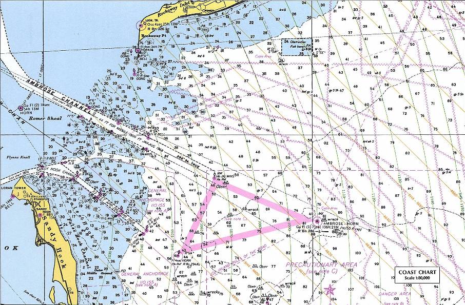
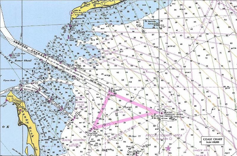
Image: New York Harbor Nautical Chart
Description: Nautical chart including LORAN TD lines for ocean approaches to New York Harbor. The chart shows TD lines, apparently for LORAN-A, which would make it the Nantucket-Chatam-Montuck-Sandy Hook-Fenwick-Bodie Is-Cape Hatteras chain. Note that the printed TD lines do not extend into inland waterway areas, as LORAN propagates poorly over land. The green 1000 lines curve heavily in this area. Note the "LORAN TR" mark at the tip of Sandy Hook near the focus of the curves. This would be Station "J" (3H5). The ochre 4000 lines (3H4) would correspond to the TD between the master and Station "H" at Cape Hatteras. The master station of this chain was at Sankaty Head on Nantucket, Massachussets. [1] The sharp angle between these sets of TD rings, especially to the east and north, would make it a poor pair for precise navigation. This is a detail of the original at: Source: Perry-Castañeda Map Collection, University of Texas at Austin URL: [2]
Title: New York Harbor Nautical Chart
Credit: Perry-Castañeda Map Collection, University of Texas at Austin - Original URL (detail) - Copyright statement Originally uploaded on en.wikipedia; the description page was written by User:KeithTyler, and imported from here.
Author: Unknown authorUnknown author
Permission: PD-LAYOUT; PD-USGOV.
Usage Terms: Public domain
License: Public domain
Attribution Required?: No
Image usage
The following page links to this image:
