
Image: Newtonia II Battlefield Missouri
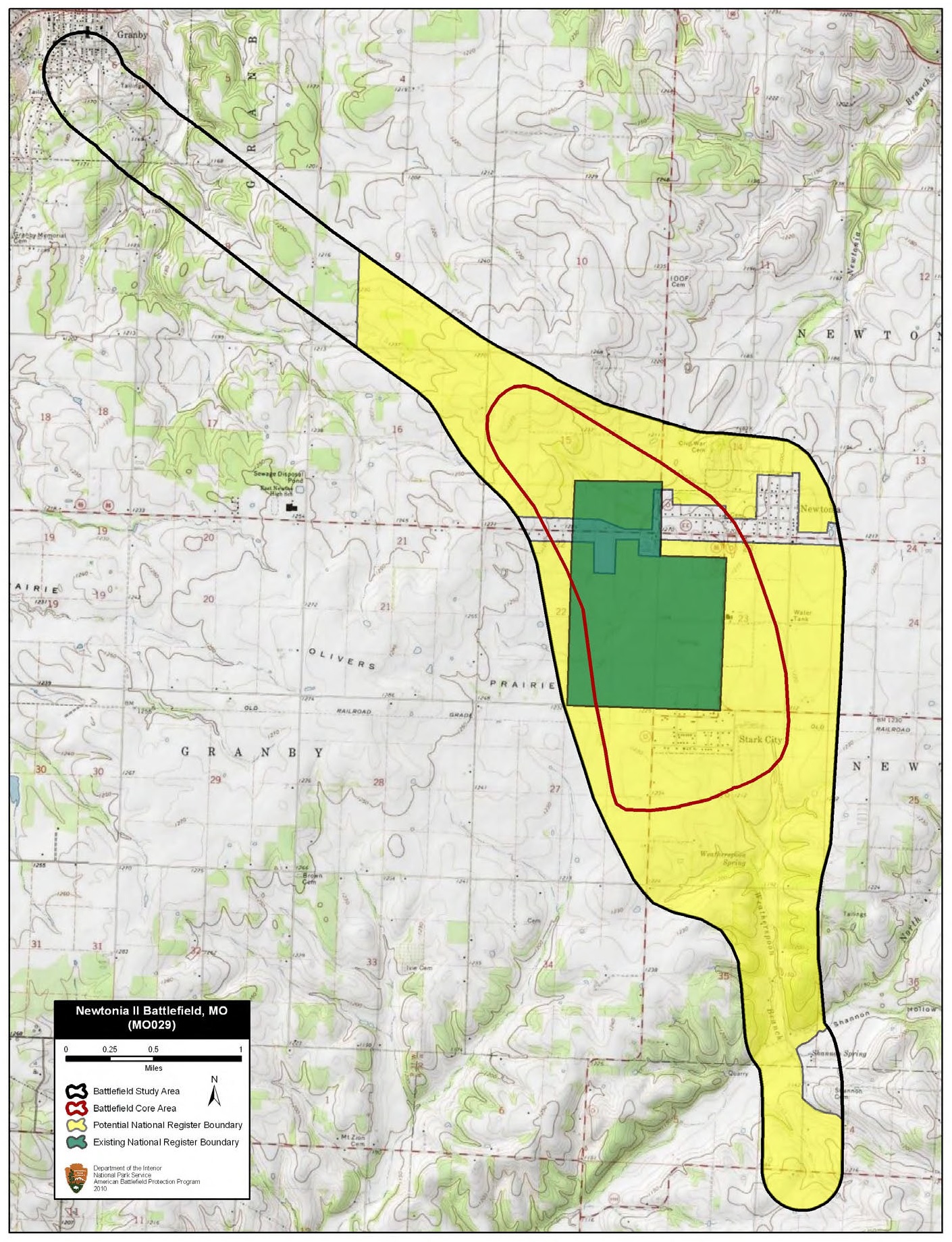
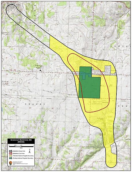
Description: Map of battlefield core and study areas. The ABPP redrew the 1993 Study Area to include the ground (from modern day Stark City to the historic Granby Road) over which Blunt’s and Shelby’s forces fought, and to include the cornfields through which Sanborn’s reinforcements pressed Shelby’s division. Also included is the historic Granby Road, which both forces used at the beginning of the battle (segments of the road are still discernable on the landscape). The ABPP widened the Study Area to account for Confederate movements from the northwest into Newtonia, movement along the Pineville Road from Newtonia to the Confederate camp south of Newtonia, the Confederate encampment area, and the Confederate route of withdrawal from the camp to the south. The ABPP expanded the 1993 Core Area significantly to take in the full sweep of the general engagement between Blunt’s and Shelby’s forces and the later engagement between Sanborn’s reinforcements and Shelby’s division. The Core Area also now includes the position of the 1st Colorado Battery on the bluffs northwest of Newtonia.
Title: Newtonia II Battlefield Missouri
Credit: National Park Service
Author: American Battlefield Protection Program
Usage Terms: Public domain
License: Public domain
Attribution Required?: No
Image usage
The following 2 pages link to this image:
