
Image: Niigata Bypass NetworkMap

Size of this PNG preview of this SVG file: 800 × 598 pixels. Other resolution: 320 × 239 pixels.
Original image (SVG file, nominally 1,897 × 1,418 pixels, file size: 1.13 MB)
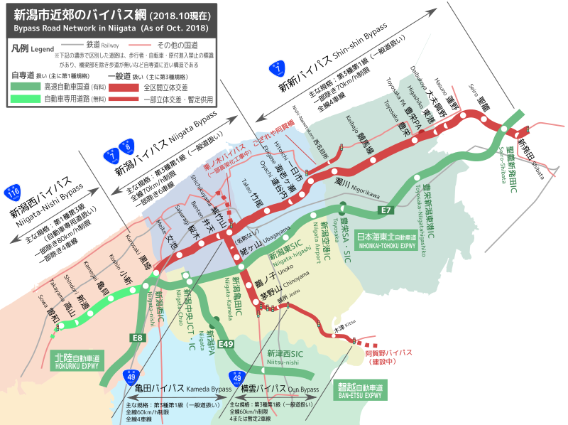
Description: 新潟西バイパス・新潟バイパス・新発田バイパス・亀田バイパスなど新潟市近郊のバイパス網を表した路線図。 ※Inkscapeにて作成。編集可能なファイル形式ですので間違い等ありましたらご自由に編集お願いします。
Title: Niigata Bypass NetworkMap
Credit: Own work
Author: Hksn127
Usage Terms: Creative Commons Attribution-Share Alike 4.0
License: CC BY-SA 4.0
License Link: https://creativecommons.org/licenses/by-sa/4.0
Attribution Required?: Yes
Image usage
The following page links to this image:

All content from Kiddle encyclopedia articles (including the article images and facts) can be freely used under Attribution-ShareAlike license, unless stated otherwise.