
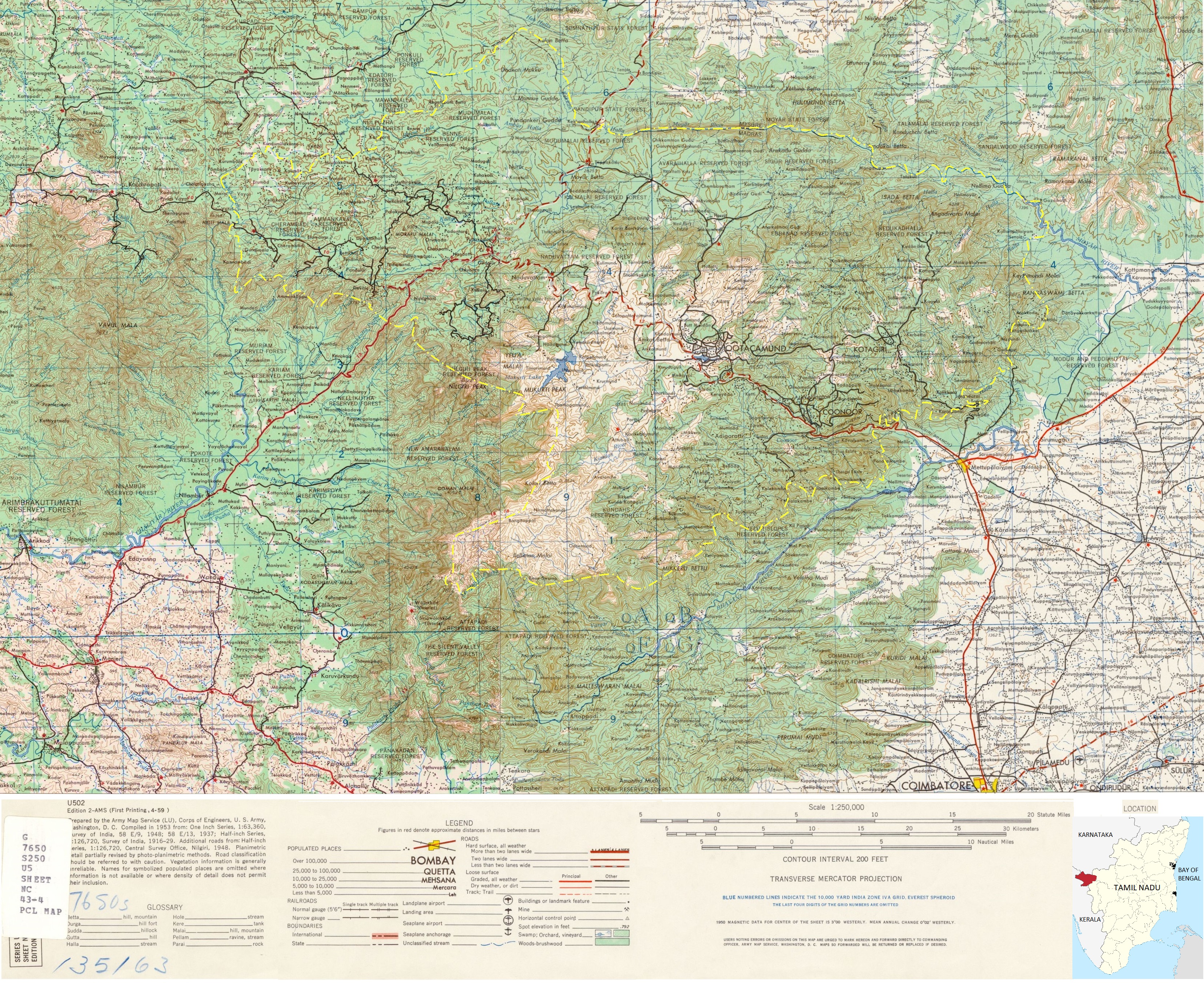
Image: Nilgiris district map 1953 with legend
Size of this preview: 734 × 599 pixels. Other resolutions: 294 × 240 pixels | 3,312 × 2,704 pixels.
Original image (3,312 × 2,704 pixels, file size: 4.28 MB, MIME type: image/jpeg)
Description: 1953 US Army map of Nilgiris district, scale 1:250,000. The image is obtained from NC 43-3 Calicut and NC 43-4 Erode US Army map. Then it is cropped, scaled, merged and color adjusted. Also a yellow Nilgiris district outline is added.
Title: Nilgiris district map 1953 with legend
Credit: India and Pakistan 1:250,000 - Series U502, U.S. Army Map Service, http://legacy.lib.utexas.edu/maps/ams/india/nc-43-04.jpg
Author: U.S. Army Map Service Cropped and labeled by Vigneshdm1990
Usage Terms: Creative Commons Attribution-Share Alike 4.0
License: CC BY-SA 4.0
License Link: https://creativecommons.org/licenses/by-sa/4.0
Attribution Required?: Yes
Image usage
The following page links to this image:

All content from Kiddle encyclopedia articles (including the article images and facts) can be freely used under Attribution-ShareAlike license, unless stated otherwise.