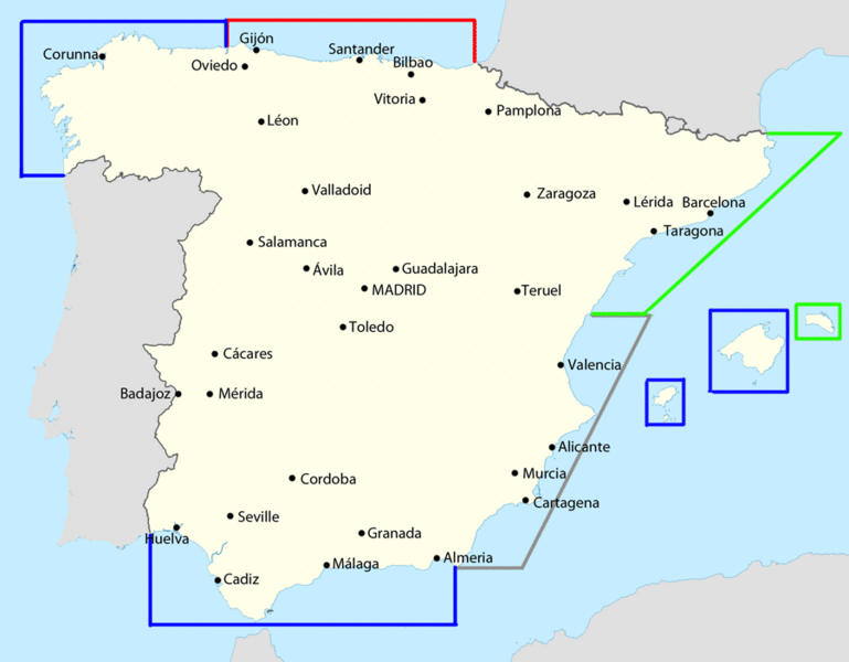
Image: Non-intevention control zones in the Spanish Civil War

Description: Map showing the control zones of four countries (red - the United Kingdom; blue - France; green - Italy; grey - Germany) as put forward and implemented in the Spanish Civil War. Note: these are areas of coastline, rather than sea zones. Data comes from Thomas, Hugh (1961) The Spanish Civil War (1st ed.), London: Eyre and Spottiswoode, p. 395
Title: Non-intevention control zones in the Spanish Civil War
Credit: File:Iberian Peninsula location map.svg
Author: NordNordWest, modifications by user:Sting, Grandiose (talk · contribs)
Usage Terms: Creative Commons Attribution-Share Alike 3.0
License: CC BY-SA 3.0
License Link: https://creativecommons.org/licenses/by-sa/3.0
Attribution Required?: Yes
Image usage
The following page links to this image:

