
Image: Norfolk Island location map

Size of this PNG preview of this SVG file: 609 × 599 pixels. Other resolution: 244 × 240 pixels.
Original image (SVG file, nominally 1,201 × 1,182 pixels, file size: 88 KB)
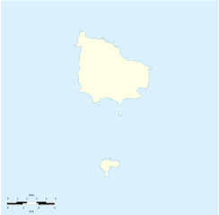
Description: Location map of Norfolk_Island Equirectangular projection. Geographic limits of the map: N: 28°58' S S: 29°10' S W: 167°52' E E: 168°02 E
Title: Norfolk Island location map
Credit: Own work Détail de la carte Norfolk Island [1] Détail de la carte Nepean Island [2] Détail de la carte Philip Island [3]
Author: Xfigpower
Usage Terms: Creative Commons Attribution 3.0
License: CC BY 3.0
License Link: http://creativecommons.org/licenses/by/3.0
Attribution Required?: Yes
Image usage
The following 2 pages link to this image:

All content from Kiddle encyclopedia articles (including the article images and facts) can be freely used under Attribution-ShareAlike license, unless stated otherwise.