
Image: North Captiva Island (Pine Island Sound, Florida, USA) (24513927871)
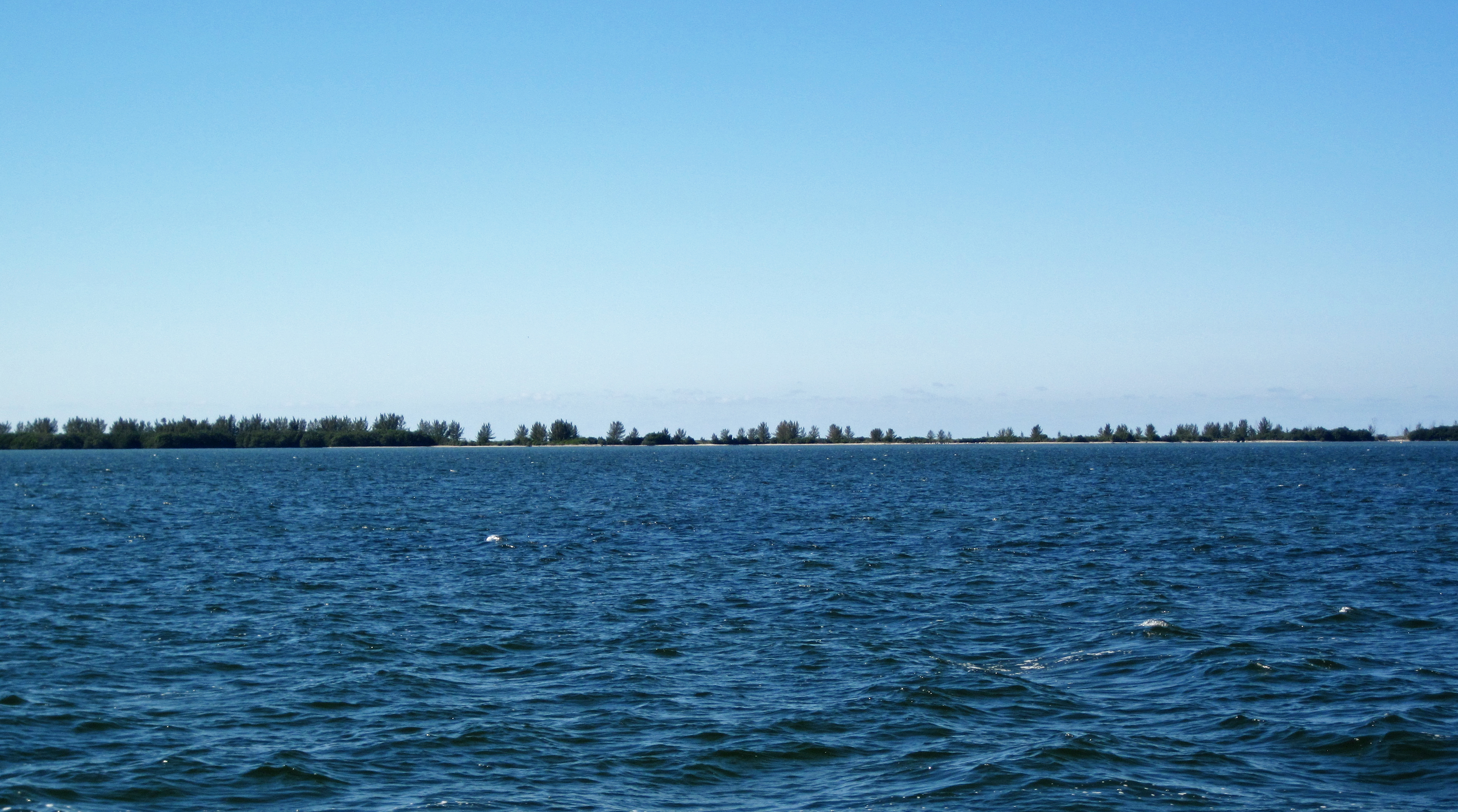
Description: North Captiva Island & Pine Island Sound in Florida, USA. (January 2016) Island = North Captiva Water in the foreground = Pine Island Sound North Captiva Island is one of dozens of barrier islands in the West-Central Florida Barrier Chain. This 191-mile long, slightly sinuous stretch of islands is located along the Gulf of Mexico coast of southern Florida. The southern-most island in the chain is Cape Romano Island. The northern-most islands are the Anclote Keys. North Captiva Island is located between Captiva Island and Cayo Costa Island, offshore from the towns of Fort Myers and Cape Coral, Florida. Most of North Captiva Island is state park land. Development with homes is only present on the southernmost tip and northernmost part of the island. North Captiva is on the western side of Pine Island Sound, a large lagoon just south of Charlotte Harbor. Two tidal inlets border North Captiva Island - Redfish Pass to the south and Captiva Pass to the north. North Captiva Island and nearby Cayo Costa Island, Captiva Island, and Sanibel Island are Holocene barriers that rim the western and southern sides of a Late Miocene depression that is now Pine Island Sound. Middle Miocene limestone bedrock was subject to significant dissolution and karst/cave development. The Pine Island Sound area was a large karst depression in the Late Miocene. It is now filled with sediments - most of modern Pine Island Sound is significantly shallow. The sparsely-vegetated portion of the island shown near the middle of the above photo is the former site of Charley Pass, which formed in summer 2004 by a hurricane. Sedimentation has refilled the pass and North Captiva is currently one intact island. Before the early 1920s, North Captiva was connected with Captiva Island, to the south (= off the left margin of this photo). The two islands are now separated by a tidal inlet called Redfish Pass, located at the site of a former agricultural field. Roots from native plants stabilized the abundant loose surface sediments and prevented much removal of material during storms. After the native plants were removed and cultivated plants were introduced, the loose surface sediments were highly prone to storm-induced erosion. This is exactly what happened in 1921, when a hurricane passed over this part of Florida. Strictly speaking, Redfish Pass is not natural and Captiva Island is not naturally divided into two parts - these features formed as a result of human-caused environmental disruption. Access to North Captiva Island is by boat or small airplane. West-Central Florida Barrier Chain geologic info. synthesized from: Evans et al. (1985) - Bedrock controls on barrier island development: west-central Florida coast. Marine Geology 63: 263-283. Davis (1989) - Morphodynamics of the West-Central Florida barrier system: the delicate balance between wave- and tide-domination. Proceedings, Koninklijk Nederlands Geologisch Mijnbouwkundig Genootschap Symposium, 'Coastal Lowlands, Geology and Geotechnology', 1987: 225-235. Evans et al. (1989) - Quaternary stratigraphy of the Charlotte Harbor estuarine-lagoon system, southwest Florida: implications of the carbonate-siliciclastic transition. Marine Geology 88: 319-348.
Title: North Captiva Island (Pine Island Sound, Florida, USA) (24513927871)
Credit: North Captiva Island (Pine Island Sound, Florida, USA)
Author: James St. John
Usage Terms: Creative Commons Attribution 2.0
License: CC BY 2.0
License Link: https://creativecommons.org/licenses/by/2.0
Attribution Required?: Yes
Image usage
The following page links to this image:

_(24513927871).jpg)