
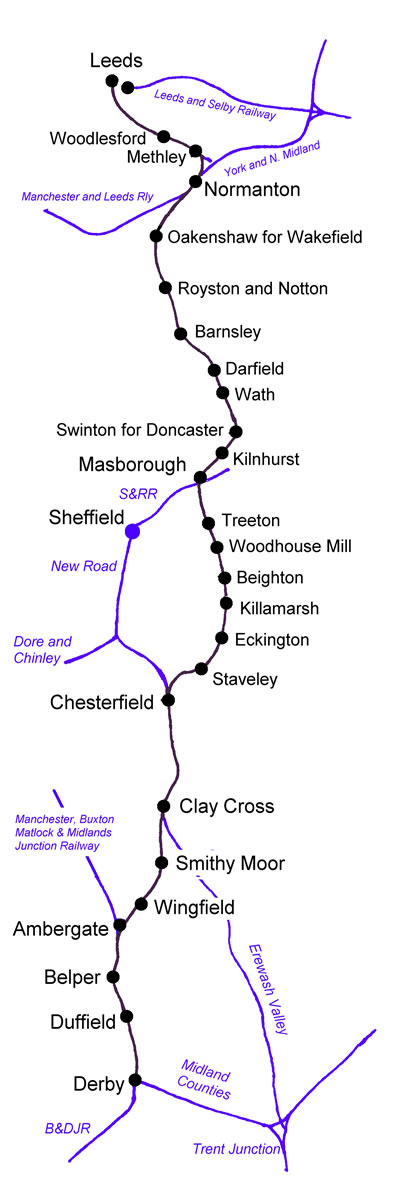
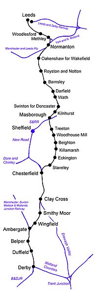
Image: North Midland Railway (connectivity map, 2008)
Size of this preview: 202 × 597 pixels. Other resolutions: 81 × 240 pixels | 400 × 1,183 pixels.
Original image (400 × 1,183 pixels, file size: 73 KB, MIME type: image/jpeg)
Description: Map of North Midland Railway and associated lines
Title: North Midland Railway (connectivity map, 2008)
Credit: self
Author: chevin
Permission: free use
Usage Terms: Public domain
License: PD
Attribution Required?: No
Image usage
The following page links to this image:

All content from Kiddle encyclopedia articles (including the article images and facts) can be freely used under Attribution-ShareAlike license, unless stated otherwise.
.jpg)