
Image: Northern VA 1864 Early
Size of this preview: 800 × 455 pixels. Other resolutions: 320 × 182 pixels | 877 × 499 pixels.
Original image (877 × 499 pixels, file size: 331 KB, MIME type: image/png)
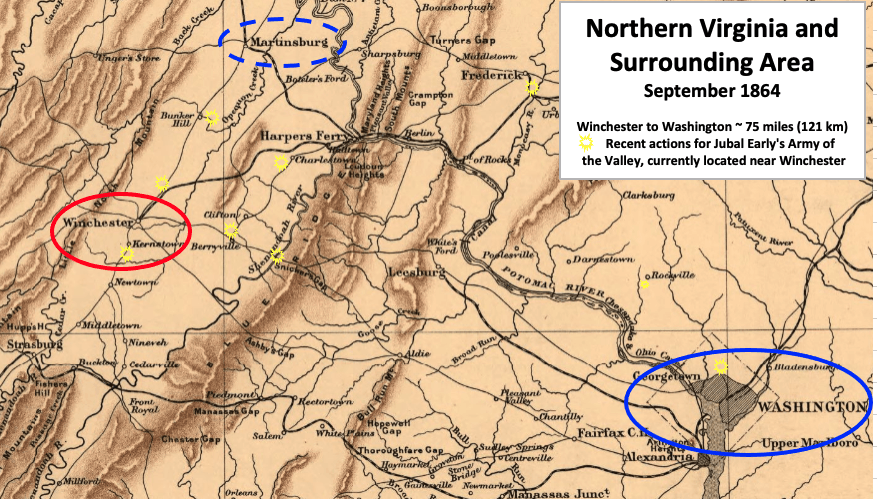
Description: This American Civil War map shows the proximity of Winchester, Virginia, which was occupied by Confederate troops in 1864, to the United States capital in Washington, DC. Actions with Confederate General Jubal Early in July, August, and September have been marked.
Title: Northern VA 1864 Early
Credit: This is a portion of a 1912 map created by Sifton, Praed & Co. that has been modified by TwoScarsUp. The entire map can be found in the Library of Congress map, and shows Virginia and Maryland.
Author: Sifton, Praed & Company, Ltd. modified by TwoScarsUp
Usage Terms: Public domain
License: Public domain
Attribution Required?: No
Image usage
The following page links to this image:

All content from Kiddle encyclopedia articles (including the article images and facts) can be freely used under Attribution-ShareAlike license, unless stated otherwise.