
Image: Northumberland and County Durham location map

Size of this PNG preview of this SVG file: 494 × 600 pixels. Other resolution: 198 × 240 pixels.
Original image (SVG file, nominally 1,108 × 1,345 pixels, file size: 315 KB)
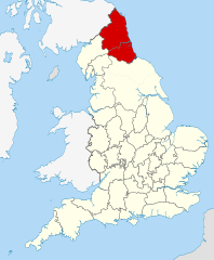
Description: A map of Modern Northumbria, defined as "an area of north-eastern England comprising Northumberland, Durham, and Tyne and Wear" [1]
Title: Northumberland and County Durham location map
Credit: This file was derived from: English ceremonial counties 2010.svg:
Author: User:Nilfanion
Usage Terms: Creative Commons Attribution-Share Alike 4.0
License: CC BY-SA 4.0
License Link: https://creativecommons.org/licenses/by-sa/4.0
Attribution Required?: Yes
Image usage
The following 2 pages link to this image:

All content from Kiddle encyclopedia articles (including the article images and facts) can be freely used under Attribution-ShareAlike license, unless stated otherwise.