
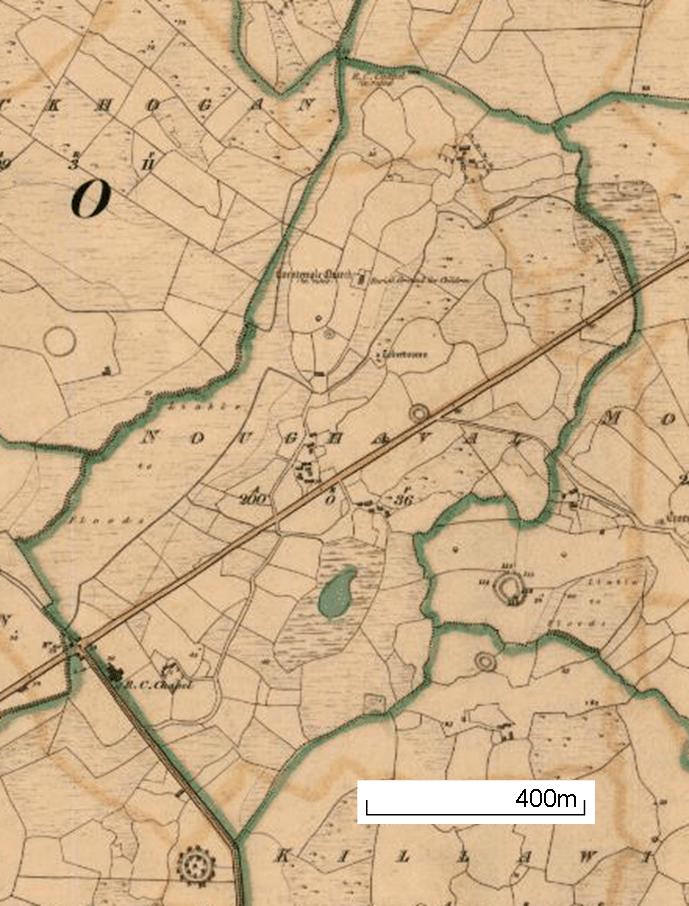
Image: Noughaval townland, Doora, Clara 1842
Size of this preview: 456 × 600 pixels. Other resolutions: 182 × 240 pixels | 689 × 906 pixels.
Original image (689 × 906 pixels, file size: 999 KB, MIME type: image/png)
Description: Detail of 1842 map showing Noughaval townland, Doora parish, County Clare, Ireland. The ruined Carntemple church is in the north, with a burial ground for children. The R.C. Chapel in the southwest of the townland is at the location of the present church of Saint Breckan's
Title: Noughaval townland, Doora, Clara 1842
Credit: http://www.clarelibrary.ie/eolas/coclare/maps/genmap/index.html#M5C-8.9113!52.83571Z15F1* (Cropped)
Author: Ordnance Survery
Usage Terms: Public domain
License: Public domain
Attribution Required?: No
Image usage
The following page links to this image:

All content from Kiddle encyclopedia articles (including the article images and facts) can be freely used under Attribution-ShareAlike license, unless stated otherwise.