
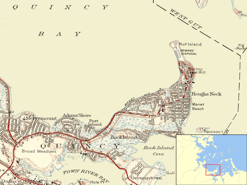
Image: Nut Island MA 1946

Size of this preview: 800 × 600 pixels. Other resolutions: 320 × 240 pixels | 1,304 × 978 pixels.
Original image (1,304 × 978 pixels, file size: 1.16 MB, MIME type: image/png)
Description: Map showing the position of Nut Island on the eastern shore of Quincy Bay with inset showing the location of the mapped area in Boston Harbor.
Title: Nut Island MA 1946
Credit: U.S. Geological Survey, obtained from University of New Hampshire collection http://docs.unh.edu/MA/hull50sw.jpg
Author: USGS
Usage Terms: Public domain
License: Public domain
Attribution Required?: No
Image usage
The following page links to this image:

All content from Kiddle encyclopedia articles (including the article images and facts) can be freely used under Attribution-ShareAlike license, unless stated otherwise.