
Image: OS map Hampton 1872 004

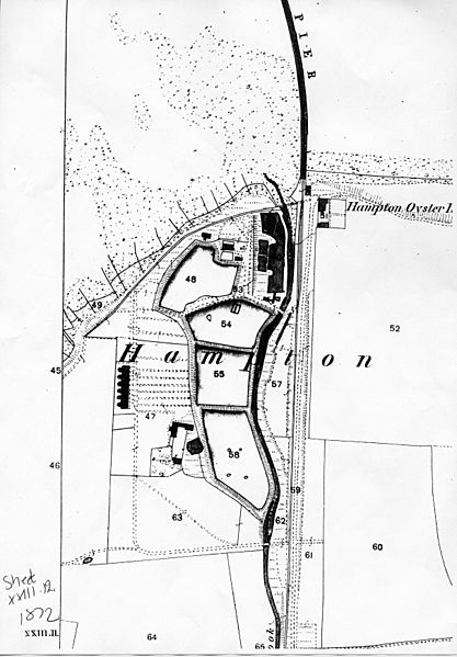
Description: Part of 1872 OS map XXIII.12 of Hampton-on-Sea in East Kent, England, showing oyster fishery buildings and fishponds, along with early stages of coastal erosion initiated by the construction of the pier in 1865. The high water level on the north coast to the east of the pier is moving north as the beach material mounts up; the coastline to the west of the pier is being eroded away and is moving south. For progression of building and erosion, compare this map with: File:OS map Hampton 1878 114.jpg File:OS map Hampton 1898 002.jpg File:Hampton 1978 001b.jpg.
Title: OS map Hampton 1872 004
Credit: Scan of photocopy of original map
Author: Ordnance Survey
Permission: copyright expired
Usage Terms: Public domain
License: Public domain
Attribution Required?: No
Image usage
The following page links to this image:
