
Image: Okolona Battlefield Mississippi
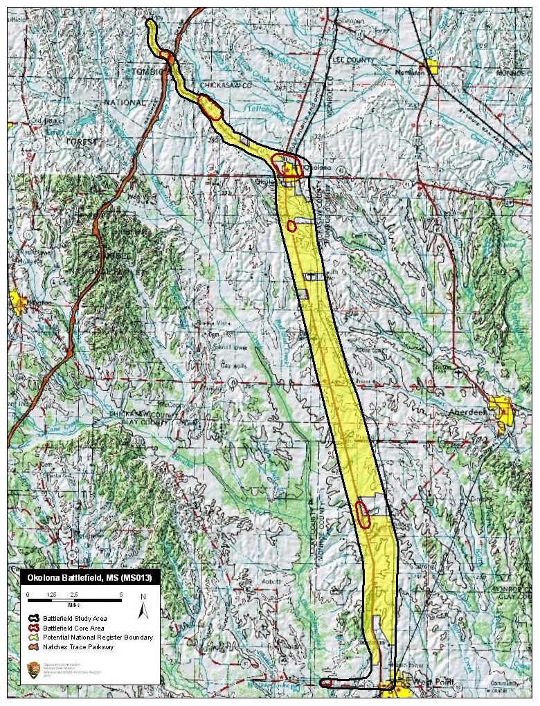
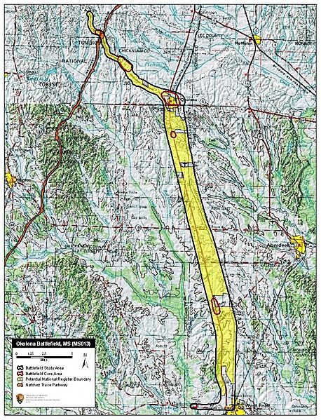
Description: Map of battlefield core and study areas. The ABPP extended the Study Area of this cavalry battle to include the Federal running retreat route through Okolona, and heavy skirmishing in areas northwest of the city and between Okolona and West Point. The ABPP repositioned the Study Area along Pontotoc Road in the northwest, and widened the boundary around Okolona to include maneuvers made by Confederate and Federal troops in preparation for the Confederate attack on Federal forces west of town. The ABPP added a new Core Area at the end of the US withdrawal route to the northwest to represent the day’s last engagement, while the existing Core Area in the north was enlarged to include the full extent of fighting around Ivey’s Hill. The Core Area around Okolona was redrawn to more accurately represent documented locations of battle. Two Core Areas were added south of Okolona along the US route of retreat. While heavy skirmishing occurred all along the retreat route, these two new Core Areas represent locations where opposing forces formed in line of battle and fought. An additional Core Area was added west of West Point around Ellis Bridge to represent the opening fight that began the Federal retreat towards Okolona.
Title: Okolona Battlefield Mississippi
Credit: National Park Service
Author: American Battlefield Protection Program
Usage Terms: Public domain
License: Public domain
Attribution Required?: No
Image usage
The following page links to this image:
