
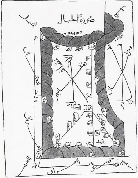
Image: Old Kurdistan Map, Ibn Hawqal

Size of this preview: 464 × 600 pixels. Other resolutions: 186 × 240 pixels | 468 × 605 pixels.
Original image (468 × 605 pixels, file size: 269 KB, MIME type: image/png)
Description: Map of Jibal (Mountains of Eastern/Northern Mesopotamia), Highlighting Summer and winter resorts of the Kurds", the Kurdish lands, in the middle of the map. From the book Surat al-Ard, 977 AC, by Ibn Hawqal.
Title: Old Kurdistan Map, Ibn Hawqal
Credit: Own work
Author: Roboskiye
Usage Terms: Creative Commons Attribution-Share Alike 3.0
License: CC BY-SA 3.0
License Link: http://creativecommons.org/licenses/by-sa/3.0
Attribution Required?: Yes
Image usage
The following page links to this image:

All content from Kiddle encyclopedia articles (including the article images and facts) can be freely used under Attribution-ShareAlike license, unless stated otherwise.