
Image: Old Military roads in Scotland

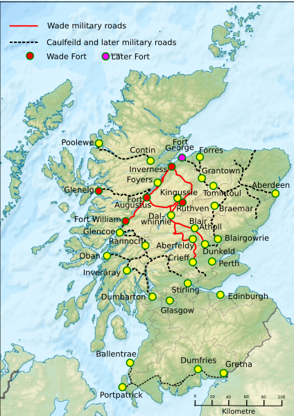
Description: Old Military roads in Scotland buit by Wade, Caulfeild and later. Information taken from Miller, James (2017). The Finest Road in the World. Berlinn. "Wade's work" pp. 45-59. ISBN 978 1 78027 430 0, particularly the map. Also Simpson, David. "UK OS map with overlay of 18th century Scottish Military Roads". Roy's Roads The Road Network from the Military Survey of Scotland, 1747. Retrieved 26 December 2019. https://roysroads.co.uk/milroads.html for the Bridge of Sark to Portpatrick route. Base map File:Scotland relief location map.jpg
Title: Old Military roads in Scotland
Credit: Own work and map derived from
Author: Thincat
Usage Terms: Creative Commons Attribution-Share Alike 4.0
License: CC BY-SA 4.0
License Link: https://creativecommons.org/licenses/by-sa/4.0
Attribution Required?: Yes
Image usage
The following page links to this image:
