
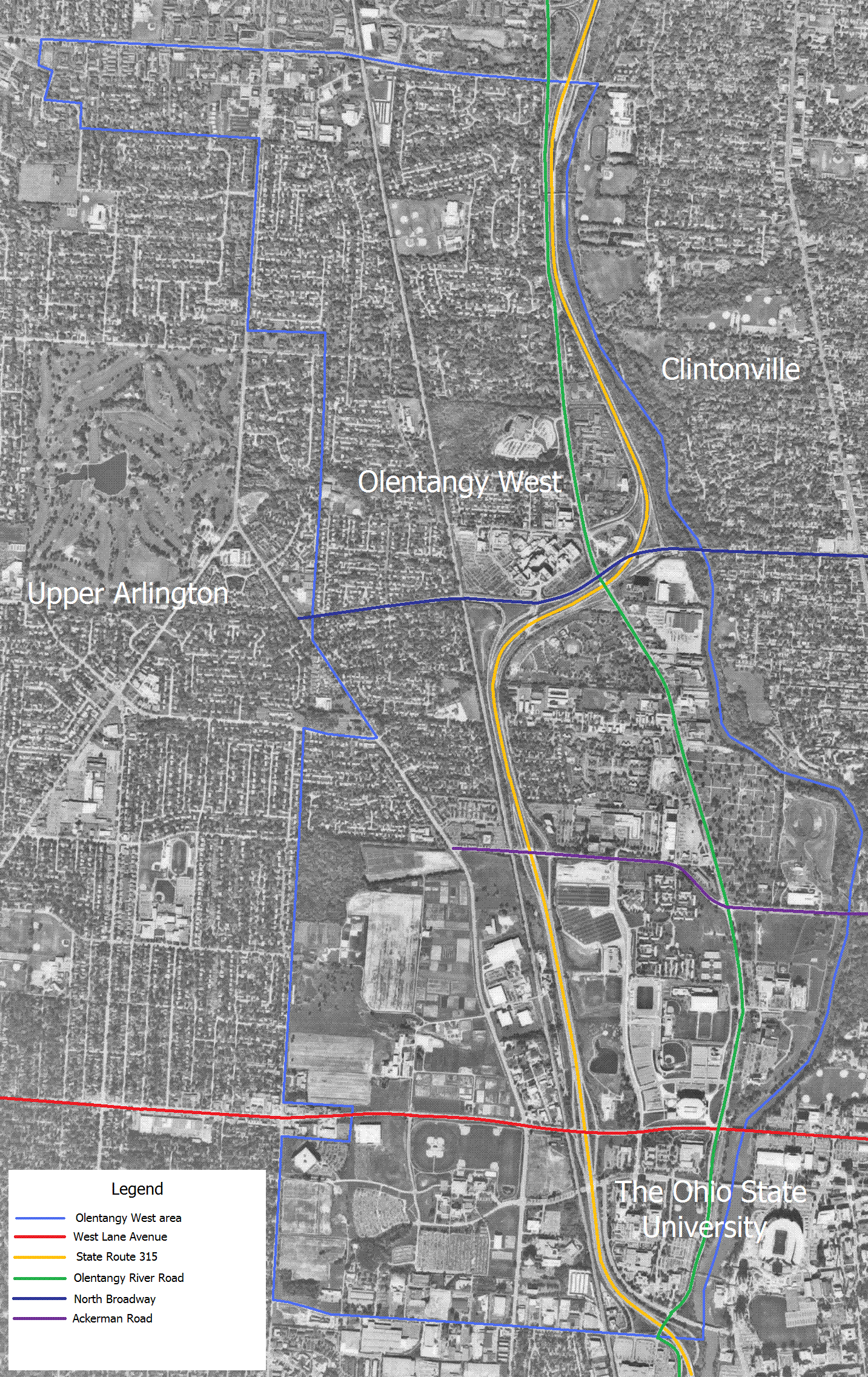
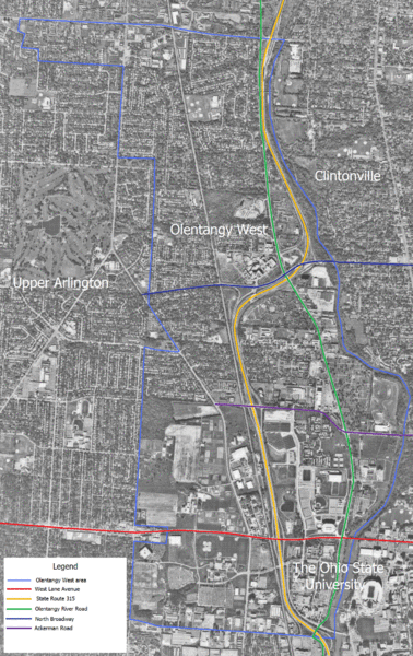
Image: Olentangy West Aerial Photo and Map
Size of this preview: 378 × 600 pixels. Other resolutions: 151 × 240 pixels | 1,433 × 2,273 pixels.
Original image (1,433 × 2,273 pixels, file size: 578 KB, MIME type: image/gif)
Description: United States Geological Survey Aerial Photo with self made map added.
Title: Olentangy West Aerial Photo and Map
Credit: Own work
Author: Analogue Kid
Usage Terms: Creative Commons Zero, Public Domain Dedication
License: CC0
License Link: http://creativecommons.org/publicdomain/zero/1.0/deed.en
Attribution Required?: No
Image usage
There are no pages that link to this image.

All content from Kiddle encyclopedia articles (including the article images and facts) can be freely used under Attribution-ShareAlike license, unless stated otherwise.