
Image: Orangeburg Massacre Map

Size of this PNG preview of this SVG file: 777 × 599 pixels. Other resolution: 311 × 240 pixels.
Original image (SVG file, nominally 1,990 × 1,535 pixels, file size: 2.42 MB)
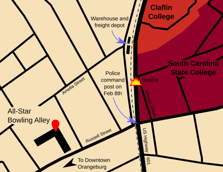
Description: The massacre took place at Watson Street, where police opened fire on students holding a bonfire vigil.
Title: Orangeburg Massacre Map
Credit: Own work, location of warehouse and freight depot sourced from Orangeburg, South Carolina (Map). Sanborn Fire Insurance Maps. Sanborn Map & Publishing Co., Ltd. July 1922. § Sheet 16.
Author: SilverStar54
Usage Terms: Creative Commons Attribution-Share Alike 4.0
License: CC BY-SA 4.0
License Link: https://creativecommons.org/licenses/by-sa/4.0
Attribution Required?: Yes
Image usage
The following page links to this image:

All content from Kiddle encyclopedia articles (including the article images and facts) can be freely used under Attribution-ShareAlike license, unless stated otherwise.