
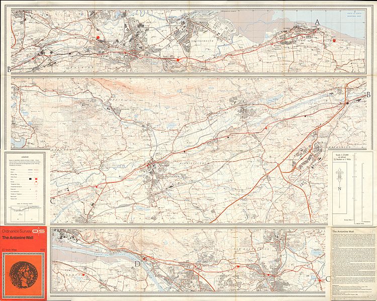
Image: Ordnance Survey Map of the Antonine Wall, Published 1969

Size of this preview: 750 × 599 pixels. Other resolutions: 300 × 240 pixels | 12,242 × 9,784 pixels.
Original image (12,242 × 9,784 pixels, file size: 50 MB, MIME type: image/jpeg)
Description: OS Map of the Antonine Wall, in Southern Scotland, at a scale of 1:25,000 or about 2.5 inches to one mile.
Title: Ordnance Survey Map of the Antonine Wall, Published 1969
Credit: Scan of original OS map
Author: Director General of the Ordnance Survey, UK
Usage Terms: Public domain
License: Public domain
Attribution Required?: No
Image usage
There are no pages that link to this image.

All content from Kiddle encyclopedia articles (including the article images and facts) can be freely used under Attribution-ShareAlike license, unless stated otherwise.